Church Recording for Church of St. Michael, Sollers Hope, Herefordshire (in the diocese of Hereford)
| Post Code HR1 4RW | Grid Ref. SO 612331 | Church Code 618249 |
THE ARTS SOCIETY Record of Church Furnishings 2019 by the ROSS-ON-WYE CHURCH RECORDERS' GROUP commenced in 2019 during the incumbency of Reverend Crispin Pemberton, completed in 2023. Recording was curtailed during 2020-2022 due to the Covid 19 pandemic.
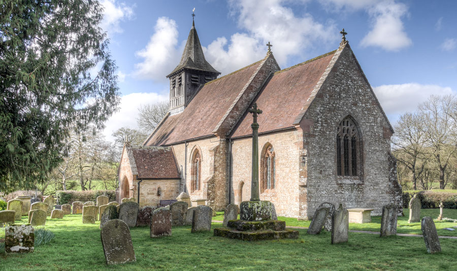
Sollers Hope is a small parish, off the B4224 old Ross to Hereford Road, 6 miles North of Ross-on-Wye and 8 miles South-East of Hereford. Hope means a high enclosed valley.
1089. The Manor of Hope is mentioned in the Domesday Book as land taken from Haghni an Anglo-Saxon freeman, passed through the Abbey of Cormeilles in Normandy owned by Ansfrid de Cormellies. His great-grandson, Walter had two daughters, one, Margret inherited the Manor, in turn leaving it to her daughter Isobel wife of Simon de Solers, in the 12th c. The Solaris family came to England at the Conquest from Soliers, near Caen, France, settling in Hereford, Brecon and Gloucester. After Simon’s death 1248, the genealogy becomes complex and confusing until Sir John de Solers (d.1311) left an only daughter, Maud. She married William de Whittington of Upton in Warwickshire who became Lord of Solers Hope. Their son another William (d.1358), had three sons the third being Sir Richard (Dick) Whittington, three times Lord Major of London.
1297. The church is listed in the Taxatio de Ecclesiastica Anglais et Walliae, with an assessment for Tax 13sh 4d., a Rector’s Pension, the Patronage of William de Whitynton.
1387. the Patron becomes Robert de Whytingtone, Lord of Sollershope and Pauntley, Gloucestershire, probably financing an early restoration of the church part of which can be seen today. About this time the church is dedicated to St. Michael.
1579. A cartographer, Christopher Saxton, with the authority of Queen Elizabeth I, produces the first atlas of County Maps, choosing to depict Sollershope on the map of Herefordshire.
1580. Ralph Sheldon (1537-1613), a Warwickshire tapestry maker commissions four great tapestry maps based on Saxton’s work. One, showing his land held in Worcestershire includes details from Saxton’s map showing Salershope at the South-West corner beside the border.
1885. Restoration of the church is undertaken by Nicholson & Sons of Hereford.
1887. The addition of a Vestry. During the excavation for the foundations four large stone coffin lids are discovered, one dated to the early 13th c. displays a shield with the arms of the de Solers family. This shield is one of the earliest instances of the use of armorial bearings in the county.
Today, the church remains nestled in the valley, surrounded by green fields, along-side the brook once named Houet, that wends its way to join the River Wye at How Caple. A scene largely unchanged for 700 years.
The Record has been sponsored by The Arts Society Ross-on-Wye.
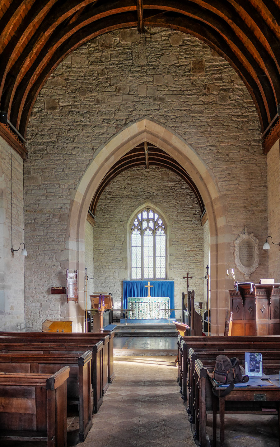
Interior Looking East
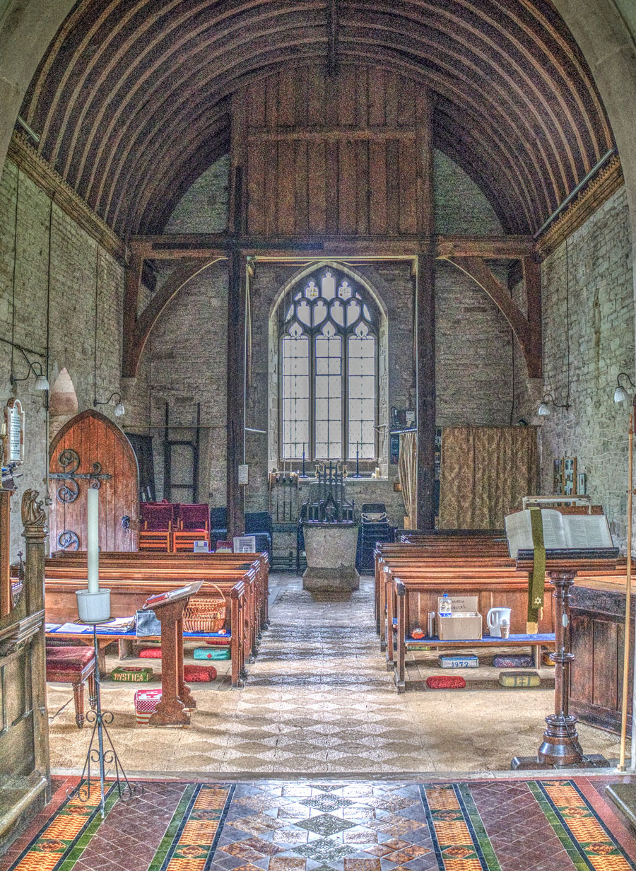
Interior Looking West
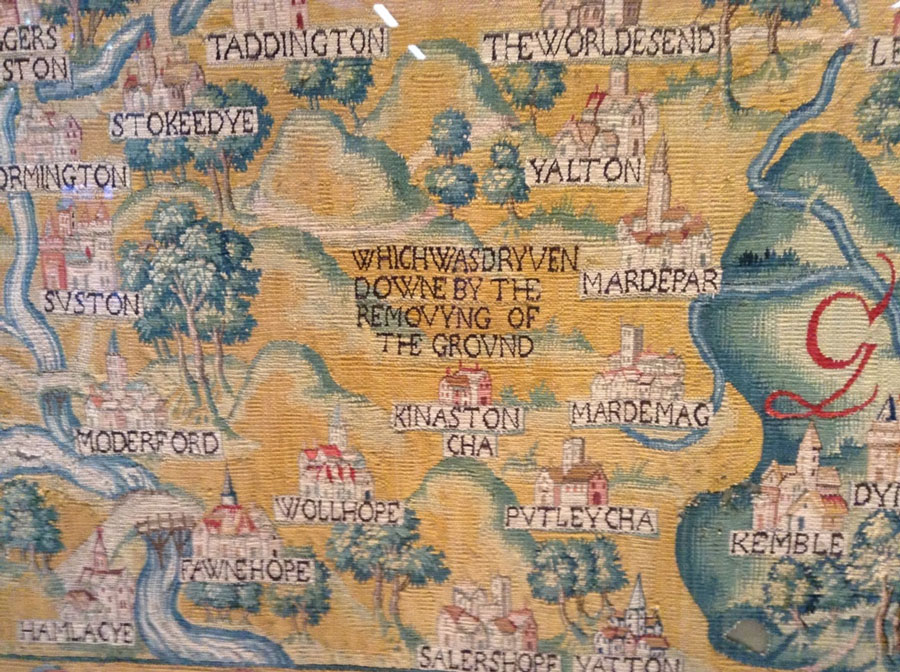
Sheldon Tapestry
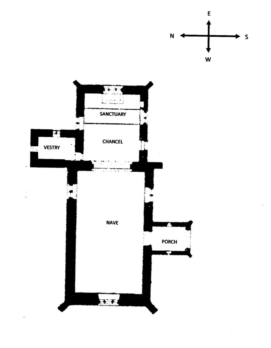
Church Plan

